The Half-Earth Project Map is a high-resolution, dynamic world map and decision-support tool that guides where place-based species conservation activities are needed the most.
The Half-Earth Project data and visualization teams work continuously to add data and new tools to the Half-Earth Project Map to inspire and guide stakeholders, decision-makers, educators, and anyone who cares about biodiversity protection so that we leave no species behind.
Over the past year, some powerful new features have been added to the Half-Earth Project Map.
- An enriched human pressure map layer reveals energy, transportation, urbanization, agriculture, resource extraction, and human intrusion at unprecedented resolution.
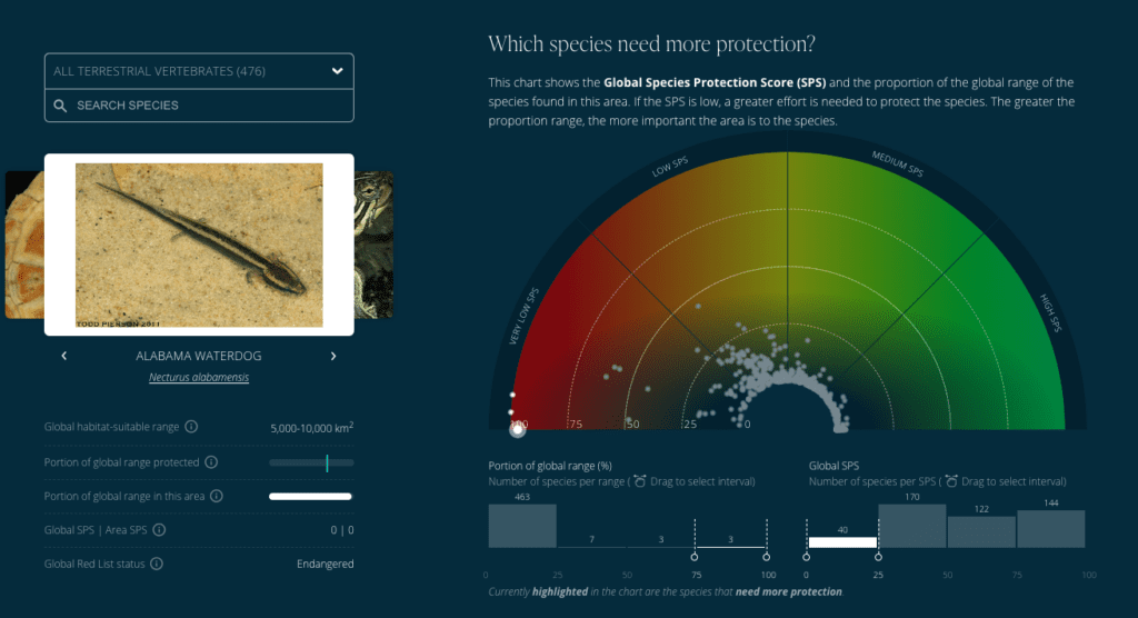
- The Analyze Areas tool calculates species protection targets met if a user-chosen area were to be conserved.
- A global marine carbon layer is now available, which adds the carbon storing power of marine environments to the terrestrial carbon layer.
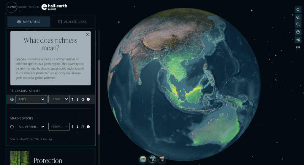
- Data for important non-vertebrate species, including global richness and rarity layers for ants, has been added to the map.
- National Report Cards, that capture the current state of biodiversity protection for the more than 200 nations of the world, measure conservation progress. Recent updates to National Report Cards show how well a country is doing to protect specific species and groups of species. In addition Species Protection Index (SPI) trends over time, human modification information and comparison graphs with other nations are available.
- Updated audio tours are available to support users.
- The Species Protection Index is being expanded to states and provinces, which will allow for analysis of progress toward species protection goals for important areas within countries.
New Features in Action