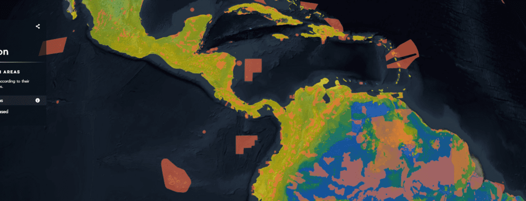

Forging emotional connections to global data sets.
By Camellia Williams, Vizzuality – July 8, 2019
Our planet is in danger. Mass extinction is threatening the stability of our planet and our own personal futures. Humans are the cause of this mass extinction, but we also hold the power to stop it. What matters most is what we choose to do next.
Securing our planet’s long-term health will require a massive change in the way we think about our planet and approach our problems. The Half-Earth Project marks the turning point of that change. Conceived by E.O. Wilson, Half-Earth is a call to conserve half the Earth’s land and sea in order to manage sufficient habitat to reverse the species extinction crisis and ensure the long-term health of our planet. But which half? The Half-Earth Map will answer this important question.
Designed and developed by Vizzuality in collaboration with the E.O. Wilson Biodiversity Foundation, Map of Life, and Esri, the Half-Earth Map presents global biodiversity data in a way that compels us to take a different look at what’s happening to our planet’s species. Guided by user research and an understanding of human psychology, the Map is an example of how to combine scientifically rigorous data with emotionally stimulating design.
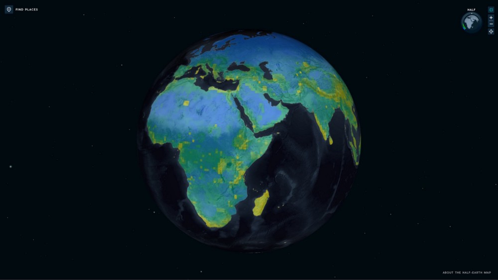

The Half-Earth Project Map is a high-resolution, dynamic world map and decision-support tool that guides where place-based species conservation activities are needed the most to save the bulk of Earth’s species, including humans.
Research tells us that people often make choices based on prior beliefs and gut feelings, even when they have access to data that conflicts with their beliefs. To overcome this bias, the Half-Earth Map team knew we’d have to help people connect on an emotional level to the data they see on their screens, thus making it more likely that they will use the data when they make an important decision.
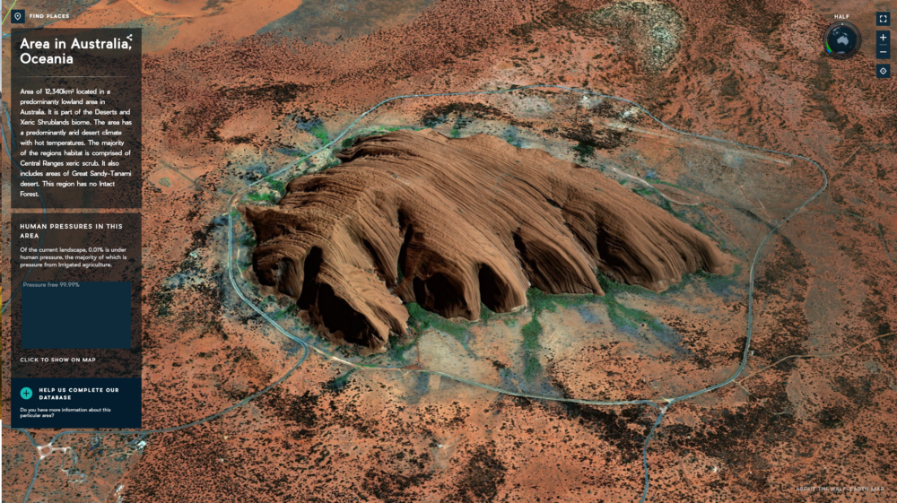

A view of Uluru-Kata Tjuta National Park in 3D captures the size and uniqueness of this culturally important sandstone monolith.
But how do you create an emotional connection with data?
Our approach is design that delights. The Half-Earth Map is a beautiful 3D globe that invites its users to explore our beautiful planet. When people first see the globe, they want to play with it. Spin it. Zoom in. Find their favourite places. As they fly across the planet and see mountains rise up before them, delight and curiosity blooms in their minds. It’s this delight that leads to exploration and the digestion of new information.
The latest iteration of the Half-Earth Map introduces a new basemap. The basemap is based on the pre-existing Firefly theme created by Esri’s Chief Cartographer John Nelson, with some tweaks made here and there with his support. We chose a dark theme as it provides the best contrast with the data layers and gives us more room to experiment with colour. As we iterate and add new data, we’ll be able to add more vibrant colours and provide visual cues that help people interpret and understand which places are the most important to conserve.
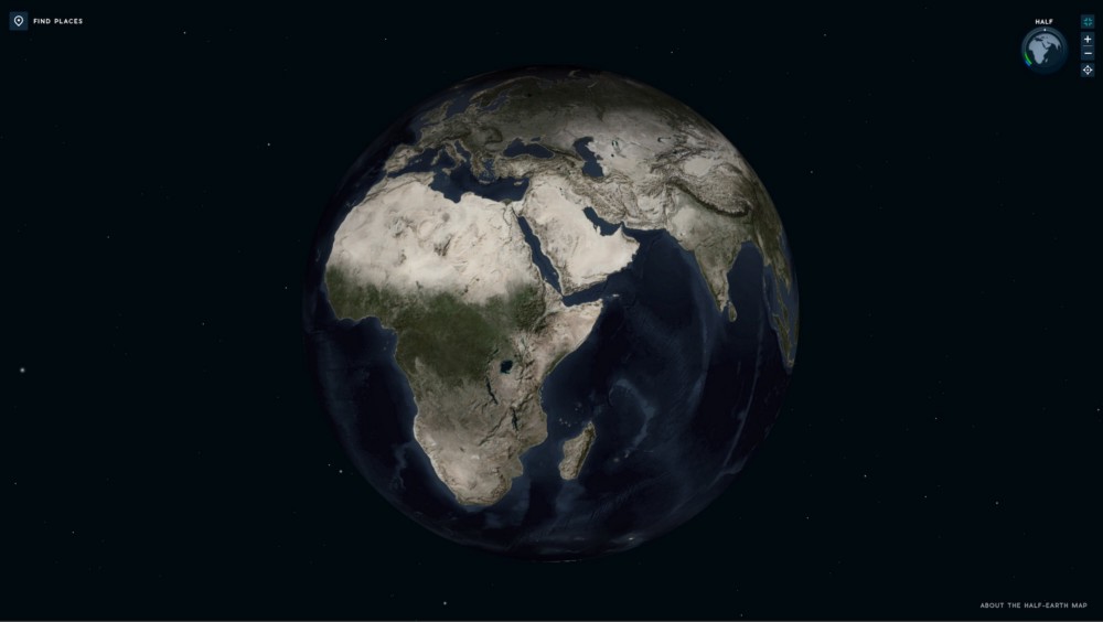

The Half-Earth base map with no added data layers.
Small design details are just as important as the big design decisions when you want to establish an emotional connection. It’s the little details that help reassure people they’re in the right place and understand what they see. For example, when a data layer is added, the circle next to the menu label will be filled with colour, so users know exactly which data layer they’ve added to the map.
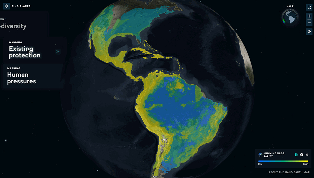

Selected data layers are identified by a coloured spot in the menu.
Another small detail is the globe within the Half-Earth progress chart in the upper right corner. As the main globe moves in response to the user’s interactions, the mini one in the progress chart does too. Even when they are zoomed in, they can still see where in the world they are by checking the globe in the progress monitor.
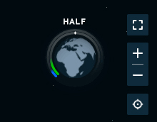

Beneath the surface.
The Half-Earth Map leverages the built-in webGL functionality of modern browsers, which taps into your laptop’s graphic card computing power to render 3D scenes. This, added to server-side calculations on Esri’s services, makes the whole map experience smoother and more performant.
The next iteration of the Half-Earth Map will be released in time for Half-Earth Day on Monday 7 October 2019. The update will include a new exciting way to explore global biodiversity data, with a more vibrant experience designed for the general public. Between now and then we’ll be seeking out feedback, and learning how people respond and interact with the map.
Rapid cycles of design, development and testing helps us ensure the tools we make are satisfying people’s needs and the goals the map is designed to achieve. If we can satisfy their needs then they will come back and keep using the data. And if we can do that, we have a chance of changing the way people think about our Planet.
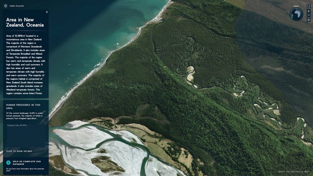

Explore the Half-Earth Map today and discover for yourself how design can help establish an emotional connection with a global data set. As the world moves towards fulfilling the goal of Half-Earth, the Half-Earth Map will give us the vast coverage of species information necessary to know where to conserve, and how to use the land and sea in a way that supports the long-term health of our planet and everything living here. With a careful application of design and tech we can achieve ambitious environmental goals such as Half-Earth and secure our planet’s long-term health.
Support Half-Earth by signing the Half-Earth Pledge.

